

 Call us:


Diploma in Remote Sensing – A Theoretical Approach
-
 By
Elizmay Vos
- 07/12/2022
Course Description
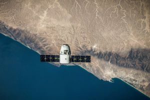
Remote sensing is an interesting part of geography and can be used in more disciplines than you might think. It is implemented in environmental management, economics, agriculture, resource management, and land cover or land use studies and mapping. However, the basic concepts and procedures stay the same regardless of the field it is used in. This course teaches you the fundamental knowledge needed to start understanding remote sensing, which is a means of collecting information about objects on earth without any direct contact with them.
You will discover the different sensor types used, the platforms on which they are mounted, and the images they produce. You first need to perform image processing to get the images from the source to a point where you can perform analyses. The different image suppliers also have image products available at different processing levels, which influences what you can do with them. Image classification is the most common analysis performed on remote sensing imagery. Therefore, we will discuss some of the different methods and classifiers that are commonly used.
You don’t need prior GIS or remote sensing knowledge or specialized software to take this course. All the essentials of remote sensing will be discussed succinctly, including its methodology and techniques used in the analysis process.
What you'll learn in this course?
-
Image Processing
-
Technology
-
Geography
-
GIS
Course Curriculum

Elizmay Vos
South Africa
$20.00
Course includes:
-
 Duration
6-10 hrs
-
 Modules
9
-
 Certifications
diploma
After you complete the course, receive a digital certificate or request a printed copy shipped to you.
